
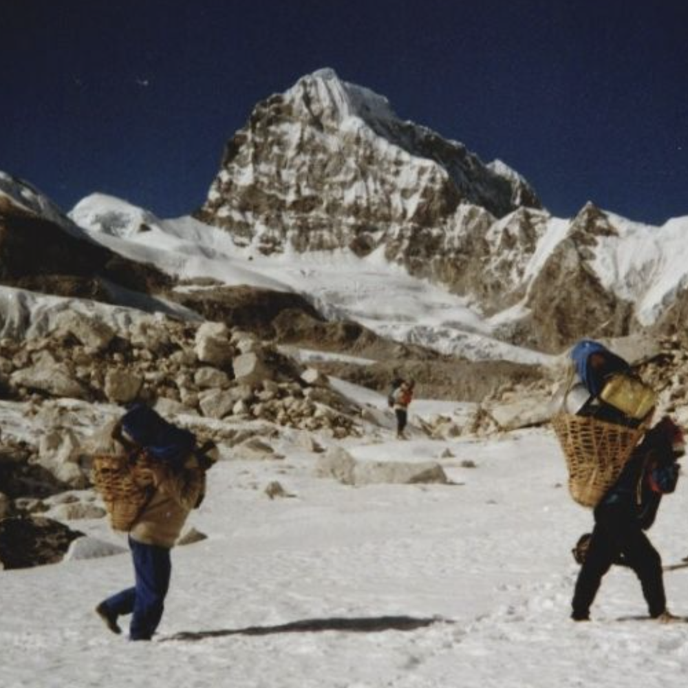
Takargo Mountain: The Forgotten Giant of Nepal’s Rolwaling Himalaya
A sanctuary of remote ice walls, sacred valleys, and the living history of Himalayan exploration.
There are mountains in Nepal whose names echo across international expedition halls and dominate global headlines[cite: 1]. And then there are giants whose stories are guarded by the few who have walked beneath their cold shadows, photographed their ice flutings, or spent weeks navigating the quiet valleys that cradle them[cite: 1]. Takargo — known variously across historical accounts as Trakargo, Thakar Go, or Dragker Go — belongs entirely to the latter[cite: 1].
Rising to an altitude of approximately 6,771 to 6,782 metres, Takargo stands deep within the Rolwaling Himalaya of Nepal’s Dolakha District[cite: 1]. Surrounded by shifting glaciers, high mountain passes, and technical peaks, it remains one of the country's most dramatic yet understated mountain environments[cite: 1].

Where Is Takargo Hidden?
Takargo is positioned inside a high-altitude amphitheatre within Dolakha District, accessible only by traversing the rugged heart of the Rolwaling Valley. The summit is anchored by a network of significant Himalayan landmarks[cite: 1]:
- Beding & Na: The principal high-altitude Sherpa settlements of the upper valley.
- Tsho Rolpa: The massive glacial lake sitting below the ice tongue.
- Glacier Systems: The complex Trakarding and Drolamboa glaciers[cite: 1].
- Neighboring Peaks: Menlungtse (7,181 m), Kang Nachugo, Tengi Ragi Tau, and Parchamo[cite: 1].
- Trashi Labtse: The high, technical pass connecting Rolwaling directly with Khumbu[cite: 1].
Official records from the Nepal Ministry of Culture, Tourism and Civil Aviation list the standard expedition route as: Charikot – Simi Gaon – Beding – Na – Rolwaling Glacier – Base Camp.
“The character of Takargo cannot be separated from the character of Rolwaling itself — a valley defined not by mass tourism, but by solitude, granite walls, and technical glacier passes.”
From Unclimbed Wall to Alpine Milestone
For decades, Takargo remained one of the premier unclimbed objectives in the Rolwaling range. American alpinists David Gottlieb and Joe Puryear first spotted the peak during their 2008 foray into the valley, when they ultimately opted to climb Kang Nachugo. Takargo, however, lingered in their plans.
When they returned in February 2010, their expedition turned into a classic exploratory campaign. Before even touching Takargo, Gottlieb and Puryear spent weeks establishing 13 frozen waterfall routes around the village of Beding — 12 of which were first ascents — demonstrating the untouched ice-climbing potential of the valley.

The Historical First Ascent Key Milestones
- Approach Route: Navigated via Trakarding Glacier to gain the high Drolamboa snowpack.
- Technical Pitching: Negotiated 1,000 metres of steep rock and hanging ice flutings graded TD.
- Crux Section: Ascended a right-side ice gully to reach a hanging glacier shelf, traversed horizontally, and tackled seven sustained ice pitches to reach the summit ridge.
A Living Cultural Landscape
A mountain's story is never written by climbers alone. During their 2010 expedition, Gottlieb and Puryear worked closely with local Sherpa residents, including Yangzum, a local woman from Beding who joined them on several ice-waterfall explorations. Their logs emphasize that the cultural relationships forged within the valley were as vital as reaching the summit.
Exploring Rolwaling with Mountain Tiger Nepal
At Mountain Tiger Nepal, we believe the Himalaya should not be defined strictly by congested commercial highways. There are still deep valleys where real exploration takes place, and Takargo remains a testament to that spirit.
We provide expedition support, trekking logistics, permits, and professional local guides for Mountain Tiger Nepal journeys throughout the Rolwaling region:
- Customized trekking routes through Beding, Na, and Tsho Rolpa.
- High-pass crossings over Trashi Labtse toward Khumbu[cite: 1].
- Glacial photography expeditions focusing on Takargo and Menlungtse[cite: 1].
- Full mountaineering logistics for technical Himalayan peaks.
